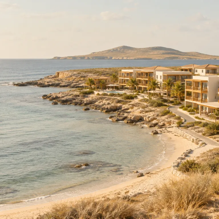
Understanding Aruba’s square miles when choosing your hotel base
Aruba covers about 180 square kilometres, which equals roughly 69.5 Aruba square miles. This compact island size means every hotel sits within easy reach of the wild north coast, the calmer south coast beaches, and Oranjestad’s urban comforts. When you compare islands in the southern Caribbean, few offer such short travel times between rugged nature and refined resorts.
The island stretches about 32 kilometres from northwest to southeast, with only around 10 kilometres across at its widest point, so those Aruba square miles feel surprisingly intimate yet varied. You can stay near Palm Beach on the leeward coast and still reach the most remote coves on the windward coast in under an hour, which is ideal for travellers who want both relaxation and exploration. This scale also helps you evaluate whether a hotel’s location really suits your plans, because “ocean view” or “north coast access” translate into very specific distances in miles and kilometres.
Although Aruba is small compared with larger Caribbean islands such as Curaçao or Bonaire, its coastline feels dramatically different from one side to the other. The north coast faces the open Caribbean Sea with pounding water and sculpted limestone, while the south and west coasts shelter calm beach areas perfect for swimming. Understanding how these contrasting coasts fit inside the limited Aruba square miles will help you decide whether to prioritise wild scenery, swimmable bays, or quick access to Oranjestad’s restaurants when booking your stay.
From Oranjestad to the north coast: how the island’s size shapes access
Oranjestad sits roughly in the western third of Aruba’s square miles, acting as the main hub for arrivals, shopping, and government. The compact layout of the island means that even if you stay in the city or near the harbour, you can reach the north coast cliffs and hidden inlets in less than 30 minutes by car. This proximity allows travellers to enjoy urban comforts at night while spending days exploring remote stretches of coast where you may see more waves than people.
Because Aruba is part of the Kingdom of the Netherlands, the road network and signage feel familiar to many European visitors, yet the landscape is pure Caribbean. The former Netherlands Antilles islands of Aruba, Curaçao, and Bonaire share some administrative history, but Aruba now functions as a separate country within the country kingdom structure. When you compare Aruba square miles with Curaçao or Bonaire square miles, you notice that Aruba’s smaller footprint actually simplifies logistics for hotel guests who want to sample several coasts in a single day.
First time visitors often worry about getting around an unfamiliar island without ride sharing services. To plan transfers from your hotel in Oranjestad or Palm Beach to the north coast, it helps to review detailed local guidance on how to get around Oranjestad when Aruba does not have Uber. Once you understand that the total Aruba square miles are modest and that taxis, rental cars, and some hotel shuttles cover these distances quickly, the island feels manageable rather than remote.
How Aruba’s history and geography meet on the north coast
The wild north coast compresses centuries of history into a narrow ribbon of land and sea. Long before Dutch or Spanish ships appeared, Caquetio Indians from the South America mainland crossed the Caribbean Sea and settled on the island, leaving petroglyphs in caves that still overlook pounding surf. When you stand on a clifftop hotel terrace or viewpoint, you are looking across the same water routes that connected these people to other Caribbean islands.
During the colonial era, Aruba shifted between Spanish and Dutch control, eventually becoming part of the wider Netherlands Antilles in the twentieth century. Over the years, the island’s strategic position in the southern Caribbean turned its north coast into a lookout line facing both South America and the open ocean. Today, when you explore hidden coves or stay in a hotel near the cliffs, you sense how these few Aruba square miles once mattered to empires that ruled multiple islands including Curaçao, Bonaire, and the distant territories of Sint Eustatius and Saba.
Modern travellers usually encounter this history through place names and preserved sites rather than forts or cannons. The Arikok National Park protects a large share of the island’s interior and eastern coast, including caves where Caquetio art survives, while the gold mill ruins at Bushiribana and Balashi recall a nineteenth century mining boom. If you are choosing a hotel as a base for exploring the north coast, it is worth reading specialised advice on how to choose the right hotel base on Aruba’s north coast, then matching that with your interest in history, hiking, or photography.
Hidden gems along Aruba’s north coast within easy reach of your hotel
The limited Aruba square miles hide a surprising number of secluded spots along the north coast. Many visitors stay near Palm Beach or Eagle Beach and never realise that within a short drive, the coast transforms into a landscape of natural bridges, blowholes, and pocket beaches framed by volcanic rock. Choosing a hotel that offers quick access to this side of the island can turn a standard beach holiday into a sequence of quiet, cinematic mornings.
One of the most atmospheric areas lies inside Arikok National Park, where unpaved tracks lead to Moro, Boca Keto, and Dos Playa, three coves that feel far removed from the resort strip. These beaches are usually unsafe for swimming because of strong water movement, yet they are ideal for sunrise walks, photography, and watching the raw power of the Caribbean Sea. When you look at a map, you realise how little distance separates these wild bays from the more polished hotel zones, which is why understanding Aruba square miles helps you plan realistic day trips.
Outside the park boundaries, the stretch between the California Lighthouse and the Alto Vista Chapel offers more accessible viewpoints and hidden corners. Here, the coast alternates between rocky shelves and small sandy inlets, and you may find yourself alone except for a few local people fishing. Hotels that promote “north coast access” often refer to this corridor, so ask precise questions about driving times in kilometres and miles, especially if you plan to visit at sunrise or sunset.
Culture, education, and daily life across Aruba’s compact territory
Despite its modest square miles, Aruba supports a diverse population and a layered cultural life. The Aruba population includes descendants of Caquetio Indians, European settlers, African slaves, and more recent migrants from South America and other Caribbean islands. This mix shapes everything from language and food to the way hotel staff welcome guests as if they were neighbours rather than anonymous visitors.
As part of the Kingdom Netherlands structure, Aruba maintains close ties with the European Netherlands while asserting its own identity as the so called happy island. The island’s status as a constituent country within the wider country kingdom framework means it has its own parliament and prime minister, while defence and some foreign affairs remain linked to The Hague. For travellers, this arrangement translates into stable institutions, reliable infrastructure, and a sense of continuity that extends from the capital to the most remote north coast trails.
Education and research also play a role in how the island manages its limited land and water resources. The University Aruba in Oranjestad contributes studies on tourism, law, and sustainability that influence how hotels are planned within the finite Aruba square miles. When you choose accommodation, you benefit indirectly from these policies, whether through protected dunes near your beach access or regulations that limit construction in sensitive coastal zones.
Comparing Aruba with neighbouring islands when planning multi stop stays
Many travellers considering a hotel in Aruba also look at Curaçao and Bonaire for a wider southern Caribbean itinerary. Aruba, Curaçao, and Bonaire once formed the core of the Netherlands Antilles, and they still share air links, cultural ties, and Dutch administrative influences. When you compare their square miles, you see how each island offers a different balance between urban life, nature, and coastline.
Aruba’s roughly 69.5 square miles feel dense with hotels and services along the west coast, while Curaçao’s larger area spreads attractions across more varied terrain. Bonaire, by contrast, dedicates a significant share of its land and surrounding water to marine conservation, making it a favourite for divers who value quiet over nightlife. Travellers sometimes combine Aruba and Bonaire or Bonaire and Curaçao in one trip, but if your priority is easy access to a dramatic north coast from a comfortable hotel base, Aruba’s compact geography is particularly appealing.
Regional flights also connect Aruba with Curaçao, Bonaire, and the smaller Dutch islands of Sint Eustatius and Saba, though schedules can change and require careful planning. Because the islands share the Caribbean Sea and sit relatively close to the South America mainland, weather patterns and sea conditions often feel similar, yet each island’s coastline reacts differently to wind and waves. When you evaluate hotel options, keep in mind that Aruba’s limited square miles concentrate its most rugged scenery along the north and east coasts, making it easier to reach hidden gems without sacrificing comfort or time.
Key figures about Aruba’s size, population, and protected areas
- Aruba covers about 180 square kilometres, or roughly 69.5 square miles, making it smaller than Curaçao and slightly larger than many single city metropolitan areas in Europe (data from the Central Bureau of Statistics Aruba) .
- The Aruba population is approximately 110,000 residents, which creates a relatively low population density compared with some other Caribbean islands, helping to preserve open landscapes along the north coast (Central Bureau of Statistics Aruba) .
- Arikok National Park protects around 20 percent of the island’s land area, a significant share of the total Aruba square miles, ensuring that large sections of the north and east coasts remain free from large scale development (Arikok National Park Foundation) .
- The highest point on the island, Mount Jamanota, rises to about 188 metres above sea level, offering panoramic views that help visitors appreciate how the limited square miles contain such varied coastlines and habitats (Arikok National Park data) .
- Average annual rainfall in Aruba is roughly 400 millimetres, relatively low for the Caribbean region, which explains the island’s arid landscapes and the hardy vegetation that clings to the north coast cliffs (Royal Netherlands Meteorological Institute) .
FAQ about Aruba’s size and north coast hotel choices
How big is Aruba compared with other Caribbean islands ?
Aruba measures about 180 square kilometres, or 69.5 square miles, which makes it smaller than Curaçao and larger than some tiny islands like Saba. This compact size means you can cross the island by car in under an hour. For hotel guests, that translates into easy day trips from resort areas to the north coast and Arikok National Park.
Is the north coast of Aruba good for swimming ?
The north and northeast coasts face the open Caribbean Sea, so waves and currents are usually strong. These areas are better suited to hiking, photography, and scenic drives than to swimming. For safe water access, most visitors return to the west and south coasts, where hotel beaches are sheltered and calmer.
Where should I stay if I want quick access to the north coast ?
Hotels in the Palm Beach and Noord areas offer a good balance between resort amenities and short drives to the north coast viewpoints. If you prefer a quieter base, some smaller properties near Arikok National Park reduce travel time to the wildest coves. Because Aruba’s square miles are limited, even Oranjestad hotels remain within reasonable distance of the cliffs and hidden bays.
Do I need a car to explore Aruba’s north coast from my hotel ?
A rental car gives you the most flexibility for reaching remote viewpoints and unpaved tracks along the north coast. Taxis can handle main roads but may be reluctant to drive into rougher sections near Arikok National Park. Many travellers rent a vehicle for at least one or two days to make the most of the island’s compact geography.
Can I visit multiple islands such as Aruba, Curaçao, and Bonaire in one trip ?
Yes, regional flights connect Aruba with Curaçao and Bonaire, allowing multi island itineraries within the southern Caribbean. Because each island has a different size and character, some travellers start with Aruba’s mix of resorts and wild coasts, then continue to Bonaire for diving or Curaçao for urban culture. When planning, factor in transfer times and flight schedules so you do not lose too many hours moving between islands.